Monthly Zonal Mean Altitude vs. Latitude Analyses for 1979-1995
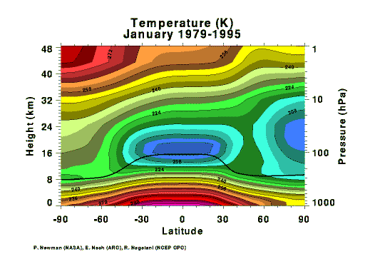
| These plots contain zonally, monthly averaged data for each month over the entire data period. The data extend from 1000 hPa to 1 hPa. Latitudes from the southern pole to the northern pole are along the x-axis and pressures or altitudes are along the y-axis. The heavy, solid line is the average tropopause level. |
Monthly Zonal Mean Altitude vs. Time Analyses for 1979-1995
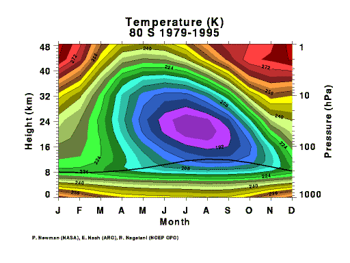
| These plots contain zonally, monthly averaged data for each month over the entire data period. The data extend from 1000 hPa to 1 hPa. Months are along the x-axis and pressures or altitudes are along the y-axis. The heavy, solid line is the average tropopause level. |
Monthly Zonal Mean Latitude vs. Time Analyses for 1979-1995
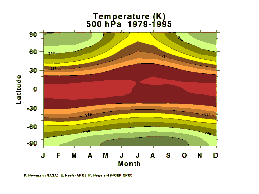
| These plots contain zonally, monthly averaged data for each month over the entire data period. The data extend from 90 S to 90 N. Months are along the x-axis and latitudes or along the y-axis. |
![[menu bar image map]](/menubar.gif)
|
Web Curator: Michael K. Heney (SSAI) ( mheney@code916.gsfc.nasa.gov)
Responsible NASA organization/official: Last Updated: Fri Feb 2 14:31:12 EST 2001 (graphs updated daily) |

|